
What is recorded here
Located in mixed woodland on the floor of the Cappagh valley. This is probably a Fitzgerald castle, although in the absence of historical references, it is traditionally thought to have been owned by the Knights Templar (Archdall 1786, 685). It is marked as a ruin on a Taylor and Skinner map (1788, 166).
This is a rectangular structure (int. dims. 6.6m N-S; 4.9m E-W) of which only the N wall survives to the first floor with evidence on the ground floor of a fireplace in the W wall, a window in the S wall and a projecting garderobe tower at the NW angle. A N-S barrel vault over the ground floor is now destroyed and the bawn (dims. c. 20m E-W; c. 15m N-S), defined by collapsed stone walls, is adjacent to the S. The cross-inscribed stone from Knockmaon church (WA030-042001-) is now outside the E wall of the bawn (Power 1918, 90). It is a granite block (min. dims. 2.25m x 0.7m; T 0.25m) with a ringed-cross in relief at the centre. (Redmond 1895, 262; O'Connell-Redmond 1918-19, 102)
Archdall, M. (1786) Monasticon Hibernicum. Dublin.
O'Connell-Redmond, G. (1918) The castles of north-east Cork and near its borders. JCHAS 24, 1-6, 62-6, 93-103, 145-51.
Power, Rev. P. (1898a) Ancient ruined churches of Co. Waterford, WAJ 4, 83-95, 195-219.
Redmond, G. (1885-6a) Notes on the history, antiquities, archaeoloical remains and legends connected with the western end of the county Waterford, JRSAI, 17, 394-405.
Taylor, G. and Skinner, A. (1778) Maps of the roads of Ireland. Reprint 1969, ed. by J. H. Andrews. Irish University Press. Shannon.
The above description is derived from the published 'Archaeological Inventory of County Waterford' (Dublin: Stationery Office, 1999). In certain instances the entries have been revised and updated in the light of recent research.
Date of upload/revision: 11th August, 2011. Compiled by: Michael Moore.
Probably built by the Fitzgerald family, it is traditionally associated with the Knights Templar, though without firm historical evidence; its location in the Cappagh valley reflects the strategic landholdings of Anglo-Norman families in the region.
This remains an important historical record, but the official description says the monument is no longer visible or has been destroyed. The monument record does not grant public access. Check the route and ask the landowner before entering private land.
- What survives
- No visible remains or recorded as destroyed
Places near here
 Fulacht FiaidhFulacht fia · 206 yd
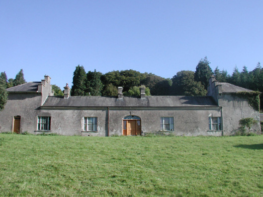 Cappagh Housecountry house · 223 yd
 BarrowBarrow, mound barrow · 381 yd
 Historic buildingOfficially recorded historic building · 1396 yd
 Black HillMountain / peak · 1516 yd
 Kilgreany CaveCave · 1.4 mi
 site of CastleCastle, unclassified · 2.5 mi
 Coillte infoboardVisitor information · 4.2 mi
 Battle of AffaneMajor battlefield · 4.3 mi
 CastleCastle, unclassified · 4.5 mi
 Dromana GateHeritage attraction · 4.6 mi
Other information
Photo: Credit not shown in the picture search · Rights wording not checked; contact us if this picture should be removed